Field Trip Round Up – Spring 2014 (part 1)

Catton

Our first post-Christmas field trip was a short one – out to the north of Norwich to Catton Park, Humphry Repton’s first commission as a landscape designer. Catton is an excellent example of the type of small, semi-urban parks which proliferated around towns and cities such as Norwich in the late eighteenth and early nineteenth centuries, as can be seen here on Faden’s map of Norfolk. The lines of old oak trees in parts of the park provide hints of the former fields which were thrown together create it.
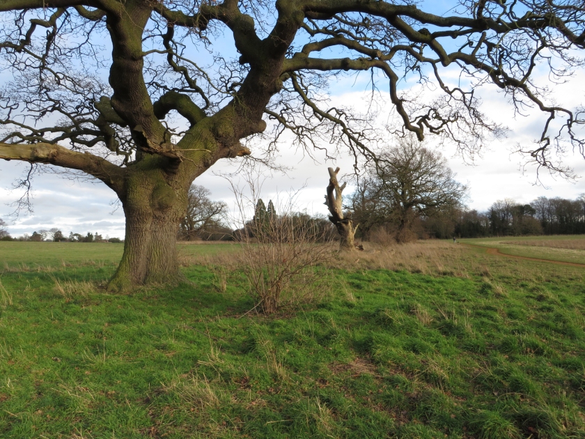
Oak pollards, once part of a hedgerow, in the park at Catton.
Third-year UEA landscape history students exploring Catton Park with Dr Sarah Spooner
Third-year UEA landscape history students exploring Catton Park with Dr Sarah Spooner. The hall is in the top-right corner.

Hockering

A return visit to Hockering, where we spent some time surveying the wood with our third-year fieldwork course in summer 2013. It all looked rather different on a cold January day as we followed the boundary of the wood and explored the remnants of a former deer park on the parish boundary between Hockering and East Tuddenham.

Looking along the boundary of a former deer park in Hockering, Norfolk.
Looking along the boundary of a former deer park in Hockering, Norfolk – taken from ‘inside’ the park.

Norwich

Our second year students began the spring semester with an introduction to medieval landscapes and buildings, including sessions on the architecture of the parish church. With Norwich on our doorstep it seemed a much better idea to spend time in the city rather than in the seminar room. Starting out under the impressive tower of St Giles we headed off on a miniature odyssey of Norwich churches – some open, some closed and some put to new uses. We looked at the churches of St Benedict (just a tower since 1942), St Swithin (now Norwich Arts Centre), St Margaret, St Lawrence, St Gregory (home to impressive medieval wall painitngs and an antiques market), St John Maddermarket, St Andrew, St Peter Hungate and finally St George Tombland where we were given an impromptu and very interesting tour by the verger.

St Lawrence, Norwich.
St Lawrence, Norwich. The 112ft tower wouldn’t quite fit in the shot…

Wolterton

As Spring started to spring our third years carried on their Grand Tour of East Anglian parks and gardens with a visit to Wolterton. Lying immediately to the north of Blickling, Wolterton Hall was designed by Thomas Ripley, with the design of the surrounding landscape attributed to Charles Bridgeman with later additions by William Sawrey Gilpin.

Student's admiring the south front of Wolterton Hall.
Students admiring the south front of Wolterton Hall as Dr Sarah Spooner outlines its history.
Exploring the stables at Wolterton.

Thetford

Reactions vary when we inform our second year students that we will be going to Thetford for a field trip. For students heading toward Norwich from various parts of the country Thetford is somewhere glimpsed from car or train windows, a name on road signs seen while contemplating whether or not the A11 does in fact go on forever. However, a sunny morning spent scaling the motte of the Norman castle, studying the ruins of the Cluniac Priory and exploring the timber-framed Ancient House meant that most went home with a more favourable perception. We also managed to catch the Lost Tudor Sculptures exhibition, part of the Representing Reformation project.

The remains of the gatehouse at Thetford Priory.
UEA landscape history students follow Dr Jon Gregory up the motte at Thetford.

Part two to follow…

A day at Orford Ness

Orford Ness

Last week we visited Orford Ness in Suffolk for a meeting to discuss the Cold War Anglia project. The isolated and atomospheric shingle spit on the coast at Orford has a long history of military activity dating back to the First World War, and has primarily been associated with experimental work. From the 1950s until the 1970s it was used by the Atomic Weapons Research Establishment to carry out various environmental tests on nuclear weapons and their components. For the Cold War Anglia project Dr Richard Maguire and team will be researching the history of Orford Ness during this period, with a view to digitally reconstructing part of the site as it would have looked during the Cold War.

Orford Ness


Orford Ness


You can find out more about the history of Orford Ness and the AWRE in Wayne Cocroft and Magnus Alexander’s recent report for English Heritage, which can be found online here. Since 1993 the site has been owned and managed by the National Trust. If you fancy visiting then there are more details on the NT website, though check carefully before you go as it’s not open every day. Many thanks to Duncan Kent and Grant Lohoar from the National Trust for making us all so welcome on the day.

Duck...


…and cover, presumably.


The Bridewell Museum, Norwich

Earlier this month the Bridewell Museum reopened in Norwich, after a £1.5m revamp. The new galleries are very impressive, telling the story of the city from the medieval period onwards.

The museum focuses on the cultural and industrial history of Norwich, as well as the daily lives of its inhabitants. One of the first new galleries is a recreation of an eighteenth-century coffee house – Norwich was well-known in the period as a cultural and social centre. In the coffee house you can try on wigs and tricorn hats, as well as leafing through copies of the eighteenth-century newspapers produced in the city.

Other galleries tell the story of the businesses and industries which made Norwich famous in the post-medieval period, particularly weaving and textile production which was a huge industry in the city during the eighteenth century. When Daniel Defoe visited Norwich in the 1720s he wrote that

If a stranger was only to ride through or view the City of Norwich for a day, he would have much more reason to think there was a town without inhabitants… if he was to view the city, either on a Sabbath-day, or on any public occasion, he would wonder where all the people could dwell, the multitude is so great. But the case is this; the inhabitants being all busy at their manufactures, dwell in their garrets at their looms, and in their combing-shops, so they call them, twisting-mills, and their other work-houses, almost all the works they are employed in being done within doors.

The museum has many examples of the cloth produced in Norwich – dresses, shawls, pattern books and more, as well as a jacquard loom – one of the last examples which was still working in the early 20th century.

Colman’s, of course, get a look in, as do Caley’s, Boulton and Paul, Start-Rite and other local companies.

There are more than 5,000 objects on display, as well as many more in drawers which you can explore for yourself.

In the entrance is a giant photo mosaic, the History Wall, made up of photographs of the city and its people contributed by members of the public. You can see some of the individual photos in the project Flickr pool, but it is worth a visit to see them all together on the History Wall.

We thoroughly recommend a visit if you are in Norwich – opening times and other details are on the museum website.

Fieldwork, Ancient Woodland and a Flypast

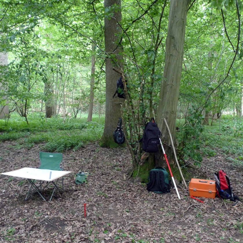
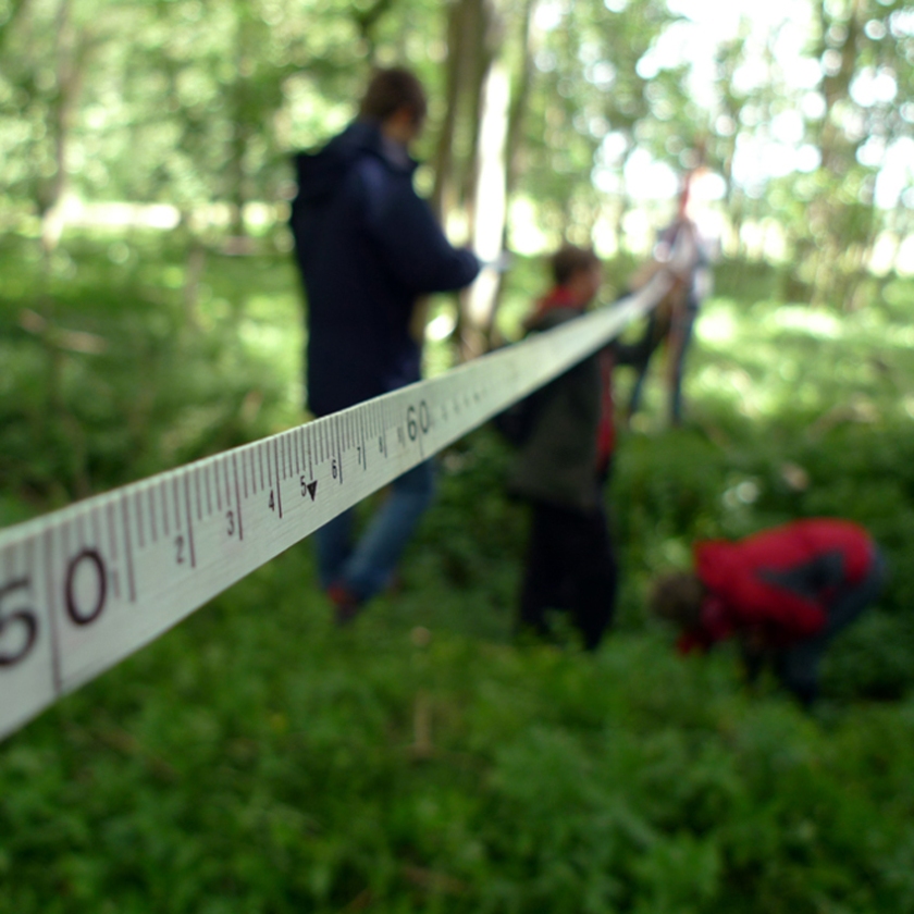
Each summer, as most students prepare to head home after exams, we gear up for our annual Field Course. This means five days on site surveying earthworks, buildings and anything else we come across that looks interesting. The fieldwork eventually leads on to a longer research project for the students, but on a warm* day in June that all seems a very long way away.

Image

*Disclaimer – fieldwork days in June may not always be warm.

Image

This year we were once again in south Norfolk, exploring ancient woodland and moated sites in the claylands of the Waveney valley. The students coped admirably with the challenges of surveying in woodland, including sighting a prism through 75m of hornbeam coppice in full leaf. Many happy hours were also spent exploring sections of woodland and puzzling over species composition and a confusing array of external and internal boundary banks and ditches.

Image

In the middle of the week our lunch break was interrupted by several large planes overhead, two of them with fighter jets alongside. Interesting, if a little odd, we thought, and promptly returned to surveying. At the end of the week all became clear when we saw the same planes in the same formation on the news, as part of the Trooping the Colour flypast.

http://www.youtube.com/watch?feature=player_detailpage&v=S8nKTparljI#t=59s

Image

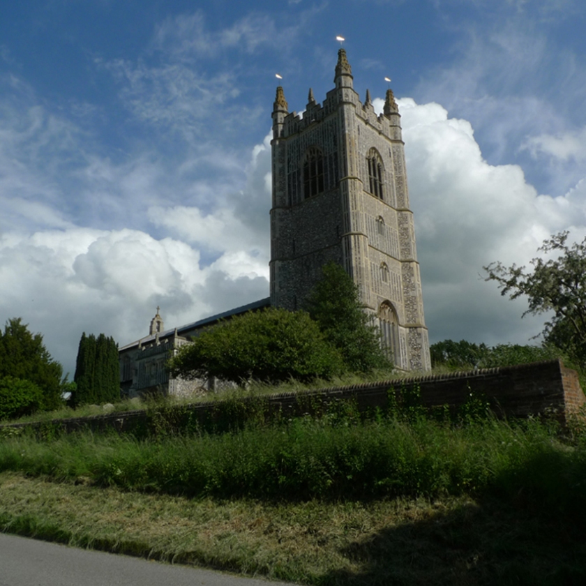
We ended the week in glorious sunshine (unusual for a summer field course) at Redenhall parish church. Much of the building dates to the 15th century and was funded by the De La Pole family. As usual in these circumstances though, we defer to Simon Knott’s excellent Norfolk Churches website.

We’ll be returning to south Norfolk in the autumn semester to continue work on drawing up and refining the earthwork plans, and hopefully to piece together a little bit more of the landscape history of this area.

Audley End

Last Friday we took our third year undergraduates to Audley End in Essex for a bit of R&R (Relaxation and Revision) in the sunshine. It was one of the most glorious days we have had for a Landscape History field trip for a few years!

Audley End has a fascinating and complex history; a monastery turned into a country house at the Dissolution, one of the largest prodigy houses in England, a royal palace and a SOE training centre for Polish operatives. The house, built between 1603 and 1614 for the Earl of Suffolk, was enormous – the present house is only a fragment of the original, but retains many original Jacobean fireplaces and plaster ceilings.

In the eighteenth century the grounds were landscaped by Lancelot ‘Capability’ Brown, and the interior of the house decorated by Robert Adam. Some of the Adam rooms have been restored, and the view from the plain, Neoclassical dining room across the Brown parkland was wonderful in the sunshine. The park is particularly interesting for the reuse of an Iron Age hillfort by Brown, who created a carriage drive and specimen planting within the ramparts.

The service wing has been restored to its late nineteenth-century heyday, as have the kitchen gardens. On some weekends in the summer the service wing comes alive with volunteers in period costume cooking and working in the kitchens and laundries.

As a complex, multi-period house and landscape, Audley End is a good place to remind our students about the relationship between architecture and landscape in the post-medieval period – how did the owners reconcile the appearance of the Brownian parkland with the Jacobean architecture of the house? Why didn’t they close that road? Why didn’t they pull it down and build a classical mansion instead? What are those earthworks? What are those two massive concrete lumps by the bridge?

Hopefully, the answers will come flowing back to them in their final exam later this week!

There is lots more information about Audley End on the English Heritage website.

Norwich Cathedral

This week we were supposed to be going on a field trip into the depths of the Norfolk countryside with the third year students who are taking the work placement unit, ‘Working in the Historic Environment’. The snow and ice, however, put us off a grand expedition and instead we stayed in Norwich and explored the area around the Cathedral.

Norwich Cathedral is one of the buildings that forms part of the Norwich 12, a selection of buildings chosen by Norwich HEART to illustrate the history of the city. Since February 2011 we have been working with HEART on a Knowledge Transfer Partnership project linked to the Norwich 12. As part of this, three of our third-year students have undertaken placements with HEART to work on the HistOracle project, writing content for the website and interactive display which will allow users to explore the history of the 12 sites in more detail.

In seminars for the Working in the Historic Environment module we have spent a lot of time discussing the challenges of presenting academic research on buildings and landscapes to the public, particularly for places like Norwich Cathedral. Sites with a long and complex history present many challenges – what to focus on, what to leave out and how to balance the stories of people, events, architecture and landscape.

During the morning we explored the Cathedral and cloister, the buildings within the Cathedral Close, Pull’s Ferry and the Cow Tower (part of the city’s medieval defences), before retiring to the Refectory for more discussion and much needed hot tea!

Cow TowerThe Cow Tower, a fourteenth-century brick tower on the bank of the river Wensum.

You can find out more about the history and architecture of Norwich Cathedral on their website – http://www.cathedral.org.uk/historyheritage/

And about the Norwich 12 project here – http://www.norwich12.co.uk/

Dunkirk, Aylsham

This week we did some more fieldwork with the Aylsham Navigation research group – this time investigating the remains of the industrial complex which grew up around the head of the Navigation in Aylsham itself.

Aylsham Mill was rebuilt in 1796 on the site of an earlier mill – some of the building has now been restored and converted into flats, whilst this section awaits further restoration.

We were able to explore the remains of a bone mill, originally built in the 1860s alongside the Navigation. The mill was operated by a steam engine, which also powered the adjacent flour mill (now a garage).

The atmospheric interior was mostly empty, but still contained a number of drive shafts and wheels which drove the machinery.

By leaning precariously out of one of the doors on the first floor we got a good view of the Navigation itself – at this point a straight channel dug out by hand in the 1770s parallel to the River Bure.

The 1880s 25 inch OS map shows the mill complex with the bone mill and corn mill clearly marked. The buildings were once much larger, and included an engine house with a large chimney, now gone.

By the 1900s ranges of stables had been added to the mill complex next to the road, which are still standing on site and which are now used as offices.

Presiding over the mills was the owner’s house, a neat example of Victorian ‘Jacobethan’ domestic architecture.

The site is now surrounded by modern housing and industry, but represents one of the most complete sections of the Navigation with the cut and the associated industrial buildings surviving almost intact, side by side.

Drawing Earthwork Plans

On Friday we took our third year undergraduate students back to the site they surveyed in June as part of their field course – a medieval moat within an ancient wood in south Norfolk.

The earthworks of the moat, and of its outer enclosure (above) were much clearer to see now that the blanket of dogs mercury has disappeared!

This gave the students the opportunity to work on their earthwork plans of the site, adding in extra details that were not easy to spot in June.

They will spend the next few weeks learning how to produce earthwork plans, before moving on to concentrate on their research projects about the history of the site. A group trip to the Norfolk Record Office this week to look at the historic maps of the wood will hopefully help to get them started!

There are more photos of the summer field course on our Flickr photostream.

Walberswick

Today we visited the village of Walberswick on the Suffolk coast to test out a heritage walk around the World War Two defences being developed by Dr Rob Liddiard.

During 1940 the beach itself was defended with a minefield, barbed wire, anti tank cubes and ‘dragons teeth’. Most of these have now gone, but on the high ground above the village and the beach there are more tangible traces of the anti-invasion defences.

A good example of a ‘Suffolk Square’ infantry pillbox (top photo) is linked to a rare set of surviving trenches constructed in 1940, and nearby is a very well preserved Observation Post (bottom photo). Both structures overlook Corporation Marshes (below), an area of marshland which was deliberately kept flooded to slow down the progress of a German invasion.

The 2nd/4th South Lancashire Regiment were stationed along this part of the coast until November 1940, after which the defences here were largely abandoned. In places woodland regeneration ensured their survival when other anti-invasion landscapes were being destroyed.

To find out more about the defence of Walberswick in World War Two visit the project website – http://www.walberswickww2.co.uk/

Attingham Park

We recently visited Attingham Park, a National Trust property in Shropshire, built in 1785 for Lord Berwick.

It was a beautifully sunny day to see the house and grounds. The Trust are doing a lot of conservation work at Attingham, and it was really interesting to see some of the ‘in progress’ work (and also to see some of the rooms staged at though it were the evening – very atmospheric).

We really enjoyed the eighteenth-century walled kitchen garden – last time we visited a couple of years ago, the kitchen garden was an empty, grassy space. Now the gardens are being restored and replanted and some of the archaeology uncovered.

This is the recently uncovered base of an eighteenth-century glasshouse, possibly for peaches or other fruit. The line of the wall against the outer wall of the kitchen garden is also clearly visible here.

On the other side of the garden wall part of the room which held the stove or boiler which heated the glasshouse has been excavated. It’s hard to see from this photo, but in the blue box at the bottom of the pit are the pieces of a rather lovely handmade glass cloche, used for protecting plants in the garden.

The kitchen gardens at Attingham are open to the public seven days a week, all year round – more details are on the National Trust website.