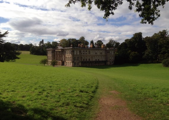
During a few days in Derbyshire at the start of September we took the opportunity to visit Calke Abbey, a few miles south of Derby. Sir George Crewe (b.1795-d.1844), former owner of Calke, went the opposite way in the early 19th century, visiting East Anglia in June 1816. In his journal [1] he recorded his thoughts on a journey, the purpose of which is not clear, made over several days from Fressingfield to Peterborough. This took him through Breckland and his observations show us something of the way the region was perceived at the time by those not familiar with it.
On leaving this place [Garboldisham] I entered on the commencement of that wild part of country which occupies so large a part of Norfolk. Cultivated only here and there in patches, and producing nothing that I could see but Rye, Oats and a small quantity of Wheat, which looked very yellow and bad. A fine country for game I should imagine. Passed at the back of a house standing isolated, as it were, in the midst of a Desert surrounded by plantations of gloomy Fir, which seemed to be the only tree this unkind soil would bear.
Monday 10th June 1816
After what he described as a ‘dreary’ ride Crewe’s spirits were raised slightly once he reached Thetford. The Bell inn had ‘Civil attendants and a tolerably good Larder’ and along the river he found ‘A beautiful walk, the bank being planted with Alders’. He continued his journey the next day, travelling from Thetford to Ely:
No sooner had I got out of the town that I found myself again in the same wild country with a road as straight as a line – neither hedge nor tree to be seen, excepting here and there patches of dark Fir. The cultivation appeared to be very irregular…what small quantity of Wheat I saw looked very wretched indeed.
[…]
The only village on this stage is that of Elvedon, which stands like a luxuriant garden in a vast waste…Round this place you turn twice, the only turns in the whole road of 12 miles.
Tuesday 11th June 1816
Notes
[1] An edited edition of Crewe’s journals was published in 2004 by Scarthin Books – C. Kitching (ed.) Squire of Calke Abbey: The Journals of Sir George Crewe 1815-1834.
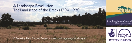
During 2016 we are working on a project looking at the changing landscape of Breckland in the period 1700-1930. If you would like to find out more about the project and how you can get involved please contact us. Click here to email us.This project is part of the Breaking New Ground Landscape Partnership. You can find out more on the BNG website – www.breakingnewground.org.uk.